|
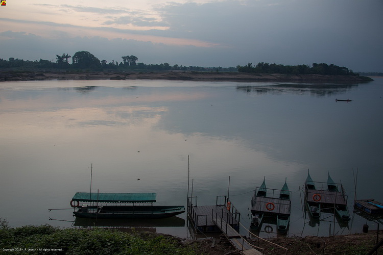
Mekong river - Champasak |
|
|
|
|
|
Address: |
|
|
|
|
|
Known as: |
|
|
|
|
|
Description: |
|
Mae Nam Khong, they call it: the Mother River. Running for more
than 2700 miles from the Tibetan Plateau all the way to the
South China Sea, this epic waterway stitches together the north
and south of Laos like a tangled, teak-tinted thread. Throughout
its history, it has borne kings and commoners, soldiers and
statesmen, monks and martyrs. It’s a sacred waterway that has
served as border, battlement and thoroughfare. It’s a
geographical landmark, but also an industrial artery, supplying
water for villages and towns, carrying passengers and cargo,
watering rice paddies and irrigating corn fields. It’s Laos’
lifeline. |
|
|
Province |
|
Champasak |
Direction: |
|
|
|
|
District |
|
Champasak |
|
|
|
City |
|
Champasak |
Comments: |
|
Official Web: |
|
|
|
|
Genre |
|
Scenery |
|
|
Related links: |
|
|
|
|
Best exposure |
|
Afternoon |
|
|
|
|
|
|
|
Rating |
|
  |
|
|
|
|
|
|
|
Opening time |
|
na |
|
|
|
|
|
|
|
Entry fee |
|
Free |
|
|
GPS : |
|
14.93026, 105.89521 |
|
| |
|
|
|
|
|
|
|
|
|
|
|